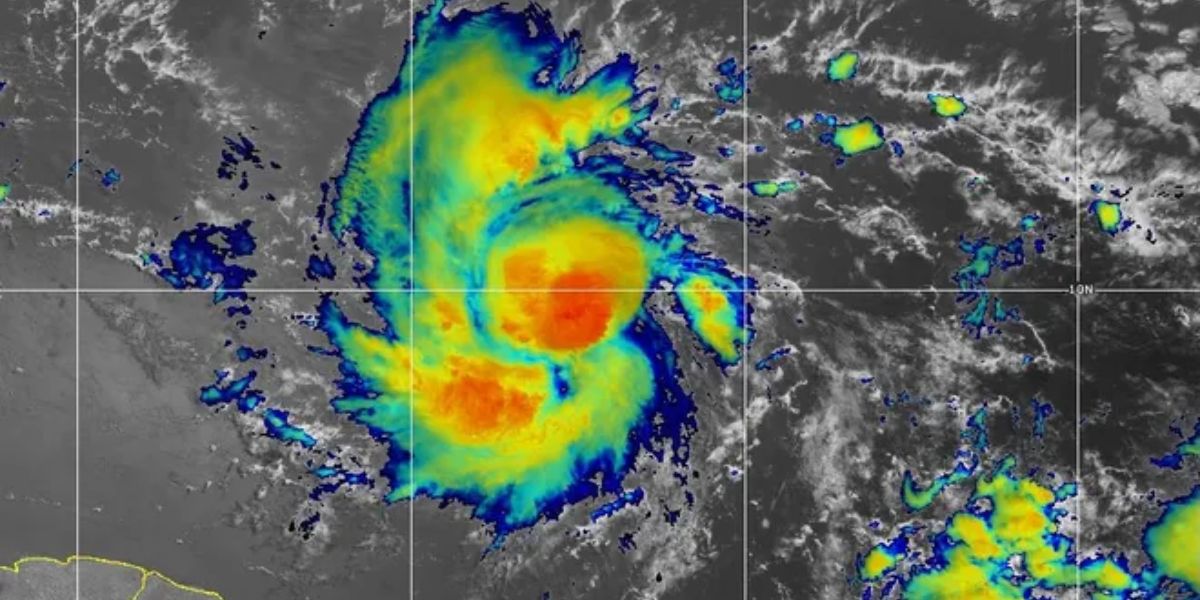
Hurricane Beryl poses a significant threat to the Windward Islands, with potentially life-threatening winds and storm surge anticipated on Monday morning, according to the National Hurricane Center.
Beryl achieved a significant milestone as it reached Category 4 status, making it a historic storm. This remarkable occurrence took place hundreds of miles east of Barbados on Sunday morning. It is worth noting that this is only the third time on record that a major hurricane has formed in the month of June.
The storm has now weakened to a Category 3 storm, however, the NHC anticipates potential fluctuations in its strength within the next day or so.
According to the most recent update, Beryl is currently situated approximately 125 miles east-southeast of Grenada. It is accompanied by maximum sustained winds of 120 mph and a minimum central pressure of 965 millibars.
The storm is currently moving in a westward direction, and it is predicted to pass through the Windward Islands on Monday morning. After that, it will continue its path over the southeastern and central Caribbean Sea from Monday to Wednesday.
Severe hurricane conditions are forecasted to start on Monday morning in Barbados, St. Lucia, St. Vincent and the Grenadine Island, Grenada and Tobago. The center of Hurricane Beryl passing through the area could result in devastating wind damage.
Anticipated rainfall amounts of 3 to 6 inches are predicted across Barbados and the Windward Islands until Monday afternoon due to the impact of a powerful hurricane. This increases the possibility of flash flooding in vulnerable areas as per Fox Orlando.
Prepare for a potentially devastating storm surge that could significantly raise water levels in affected areas. The surge is projected to be between 6 to 9 feet above normal tide levels, particularly in regions where onshore winds are present near the storm’s landfall location within the warning area.
Tragic Incident: Dunn Man Arrested for Child Abuse Resulting in Fatal Brain Injury


+ There are no comments
Add yours